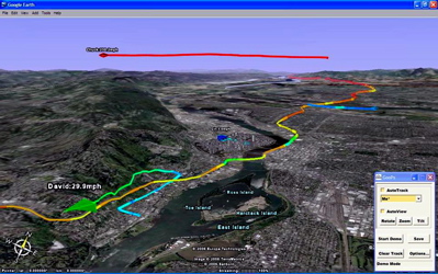
Map your trips with Google Earth and GPS Posted on March 16, 2007 by Robin Using Goops you can connect a GPS to Google Earth and map your trips, colour coded for speed. You can save and share your tracks with others. This works because Google Earth has a cache allowing you to download the area you’re going to drive in and view the areas offline. Robin razor@edgarbv.com https://www.edgarbv.com