
[…]
A team of drone enthusiasts have built a sub-$500 drone that uses a camera and Google Maps to provide itself with GPS co-ordinates, removing the need for a GPS satellite signal. And all of this was done in 24 hours during the El Segundo Defense Tech Hackathon.
[…]
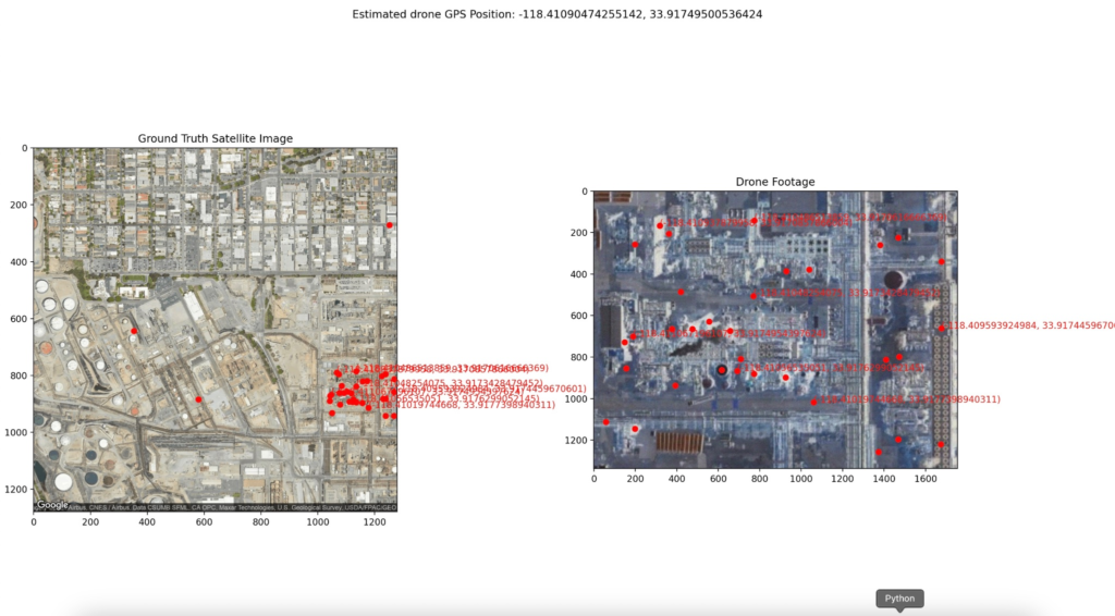
The drone uses a camera mounted underneath it to position itself with imagery from Google Maps highlighting similarities in the images to get a rough estimate of the co-ordinates
[…]
Google Maps allows users to download segments of maps ahead of time, usually for use when you are travelling or camping out in remote areas.
[…]
Without needing to rely on an external constellation of satellites, the GPS-free drone can continue operating on missions in GPS-denied environments, such as remote areas or those that have been jammed. Unlike Skydio’s approach, which uses cameras to position itself, using imagery that doesn’t rely on light to work means this drone can fly anywhere in the world it has imagery for at any time of the day or night.
[…]

Source: $500 drone calculates its position with camera, Google Maps

Robin Edgar
Organisational Structures | Technology and Science | Military, IT and Lifestyle consultancy | Social, Broadcast & Cross Media | Flying aircraft