
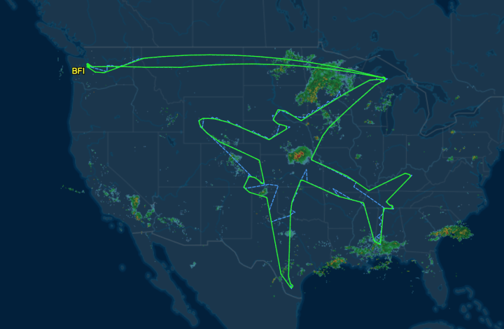
In a test flight, Boeing took the thing where you draw using your GPS path to a whole different level. They drew the outline of a plane that spanned the latitude of the conterminous United States.
Source: Boeing draws a plane in the sky with flight path | FlowingData

Robin Edgar
Organisational Structures | Technology and Science | Military, IT and Lifestyle consultancy | Social, Broadcast & Cross Media | Flying aircraft
robin@edgarbv.com
https://www.edgarbv.com