
$500 drone calculates its position with camera, Google Maps
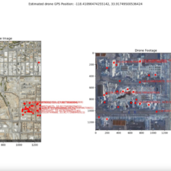
[…] A team of drone enthusiasts have built a sub-$500 drone that uses a camera and Google Maps to provide itself with GPS co-ordinates, removing the need for a GPS satellite signal. And all of this was done in 24 hours during the El Segundo Defense Tech Hackathon. […] The drone uses a camera mounted Read more about $500 drone calculates its position with camera, Google Maps[…]