Author Archives: Robin
Fake your fingerprints

Read and retransmit proximity cards
80s Radio Mixes
IRobot Scooba!

Webcam thought mice
Cybernet has released what looks like a free competitor (Navigaze) to Naturalpoint’s trackIR device. This uses a webcam to monitor you, instead of a silly silver dot on your forehead with an IR device that doesn’t like it when you smoke.
Fingerprint door handle

DARPA Robocars take 2
After not having been able to finish the first time (or making it further than 5% of the course!) they’re going to give it another bash this time: The DARPA Grand Challenge!
The team that develops an autonomous ground vehicle that finishes the designated route most quickly within 10 hours will receive $2 million. The route will be no more than 175 miles over desert terrain featuring natural and man-made obstacles. The exact route will not be revealed until two hours before the event begins
Screw AIBO
How to crack WEP
Lion kicks shit out of 42 Cambodian midgets
Spectators cheered as entire Cambodian Midget Fighting League squared off against African Lion
Tickets had been sold-out three weeks before the much anticipated fight, which took place in the city of Kâmpóng Chhnãng.
The fight was slated when an angry fan contested Yang Sihamoni, President of the CMFL, claiming that one lion could defeat his entire league of 42 fighters.
Nope 🙂
Thanks BBC for this piece of in depth, investigative reporting
The whole EU constitution read
Why the EU IP laws have to be stopped
Google Will Eat Itself
Star Wars
Long Range Acoustic Devices
nasty
http://www.atcsd.com/PressReleases/02_26_04.html
Used on their own people in the US:
http://www.infowars.com/print/ps/soundcannon_photos.htm
Used in Iraq:
http://washingtontimes.com/national/20040307-120634-6220r.htm
— Zathur
Holographic projection

Wireless lifts!

Pimp my ride

SD Wifi cards

Underwater dining

American Students not getting laid

A380 Double Bubble Flies

Cyberspace visualisation
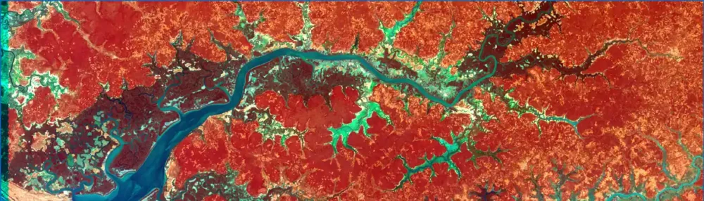
Exploring the earth and space
So there’s a whole wealth of available resources to see our planet and the solar system out there – either online or as a downloadable application. These programmes allow you to track hurricanes, cloud cover, global temperature, zoom in to varying degrees etc.
The Earth and Moon viewer is webbased and has some interesting composites
Keyhole can zoom in using satellite images to really detailed levels
This online earth viewer has a whole load of options for satellite images of the earth and space
This is a nice application bound to an online database for 1 km resolution of the earth
Earthquake 3D allows you to track earthquakes in realtime
NASA’s World Wind allows you to zoom in impressively from satellite pictures
Of course there’s that huge 3d Solar System explorer, but I can’t find the link to that anymore – anyone? 🙂