The Linkielist

Linking ideas with the world

The Linkielist

Beidou: China completes rival to the US-owned GPS system

China sent the last satellite to space on Tuesday to complete its global navigation system that will help wean it off U.S. technology in this area.

The network known as Beidou, which has been in the works for over two decades, is a significant step for China’s space and technology ambitions.

Beidou is a rival to the U.S. government-owned Global Positioning System (GPS), which is widely-used across the world.

Experts previously told CNBC that Beidou will help China’s military stay online in case of a conflict with the U.S. But the launch is also part of Beijing’s push to increase its technological influence globally.

Source: Beidou: China completes rival to the US-owned GPS system

Planet’s SkySats zoom in for a closer look at the Earth, get 50cm per pixel granularity

The remote-sensing firm Planet operates more than one hundred satellites that constantly orbit the earth, collecting imagery of the world’s entire landmass each day. Now, to offer more clarity to its customers, it has flown a handful of its satellites 50 km closer to the Earth.

This literal zoom-in effort will allow the firm to offer imagery with a resolution of 50 cm of earth per pixel, an increase from 80 cm. In one example, that means that as well as seeing the shape of a car, analysts will also be able to clearly discern the position of its windshield.

By the end of the summer, the company plans to add six new satellites to its constellation, allowing it to take those higher resolution pictures of the same area twelve times a day.

“We felt like 50 centimeters was an important threshold, but where we are really pushing the envelope is on that revisit,” Jim Thomason, a Planet vice president, told Quartz.

The ability to view the same area repeatedly means customers will get their imagery sooner after they request it, and they may be able to see what is changing on the ground. That also means a higher chance of dodging the bane of optical space imagery: clouds.

Planet
A “before” image.
An “after” image. “Orthorectified” refers to the process where sensor data taken of uneven terrain is accurately mapped onto a flat image.

Planet was founded in 2010 by former NASA scientists who wanted to leverage new advances in satellite technology and expand access to space data. Its customers include US intelligence agencies, the NGOs that second-guess them, agricultural conglomerates, and firms that use machine learning to gain insight from remote-sensing data.

Planet operates more than 150 satellites, most of which are Doves, toaster-oven sized craft that collectively “scan” the earth each day, producing imagery with a resolution about three meters per pixel. You may have seen the company’s widely-shared image of a new mural in Washington, D.C.

Source: Planet’s SkySats zoom in for a closer look at the Earth — Quartz

Astronomers have found a planet like Earth orbiting a star like the sun

Three thousand light-years from Earth sits Kepler 160, a sun-like star that’s already thought to have three planets in its system. Now researchers think they’ve found a fourth. Planet KOI-456.04, as it’s called, appears similar to Earth in size and orbit, raising new hopes we’ve found perhaps the best candidate yet for a habitable exoplanet that resembles our home world. The new findings bolster the case for devoting more time to looking for planets orbiting stars like Kepler-160 and our sun, where there’s a better chance a planet can receive the kind of illumination that’s amenable to life.

Most exoplanet discoveries so far have been made around red dwarf stars. This isn’t totally unexpected; red dwarfs are the most common type of star out there. And our main method for finding exoplanets involves looking for stellar transits—periodic dips in a star’s brightness as an orbiting object passes in front of it. This is much easier to do for dimmer stars like red dwarfs, which are smaller than our sun and emit more of their energy as infrared radiation

[…]

Data on the new exoplanet orbiting Kepler 160, published in Astronomy and Astrophysics on Thursday, points to a different situation entirely. From what researchers can tell, KOI 456.04 looks to be less than twice the size of Earth and is apparently orbiting Kepler-160 at about the same distance from Earth to the sun (one complete orbit is 378 days). Perhaps most important, it receives about 93% as much light as Earth gets from the sun.

This is critical, because one of the biggest obstacles to habitability around red dwarf stars is they can emit a lot of high-energy flares and radiation that could fry a planet and any life on it. By contrast, stars like the sun—and Kepler-160, in theory—are more stable and suitable for the evolution of life.

[…]

Right now the researchers say it’s 85% probable KOI-456.04 is an actual planet. But it could still be an artifact of Kepler’s instruments or the new analysis—an object needs to pass a threshold of 99% to be a certified exoplanet. Getting that level of certainty will require direct observations. The instruments on NASA’s upcoming James Webb Space Telescope are expected to be up to the task, as are those on ESA’s PLATO space telescope, due to launch in 2026.

Source: Astronomers have found a planet like Earth orbiting a star like the sun | MIT Technology Review

Trump’s Make Space Great Again video pulled after former ‘naut says: Nope

A funny thing happened overnight in the world of space and politics as a campaigning video featuring SpaceX’s commercial crew launch and promoting US President Donald Trump was abruptly pulled from YouTube.

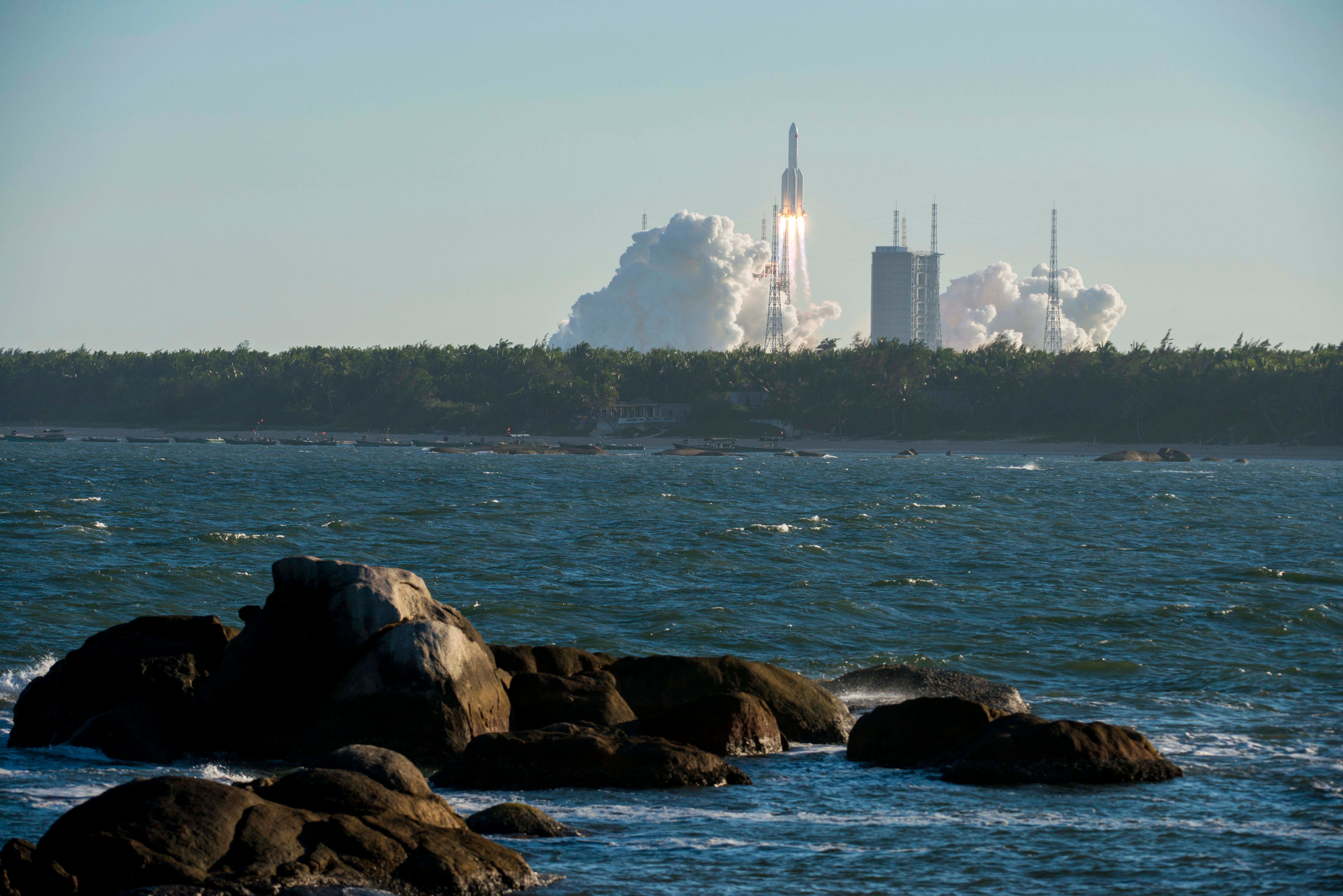
“Make Space Great Again” was uploaded to YouTube following the successful launch, attended by Trump, and featured a mix of footage including some from the Demo-2 commercial crew mission.

It also set off a firestorm of protests, including one from retired astronaut, Karen Nyberg, who is married to NASA ‘naut, Doug Hurley. Hurley is one of the two lucky crew-members of that Demo-2 mission.

Nyberg, understandably, was somewhat aggrieved that imagery of her and her son was being used in what she described as “political propaganda” without consent.

Others highlighted the unfortunate appearance of a European Space Agency (ESA) logo in the presidential campaign video.

As is so often the case these days, a petition soon popped up, urging the master of the caps-lock key to stop politicising space. After all, while the implication of the video is that if it wasn’t for the efforts of the current US President the mission might not have happened, NASA’s Commercial Crew Program was actually kicked off by President Barack Obama years previously, and has its roots in the George W Bush administration.

Sadly, the politicisation of space is difficult to avoid. President Richard Nixon, for example, was less than keen to lavish credit on John F Kennedy during the moonlandings of 50 years ago, while the space race itself was arguably driven more by political gesturing rather than pure science.

Lawmakers, after all, hold the purse strings and, as the saying goes, “No bucks, no Buck Rogers.”

As well as perhaps allowing someone to take a little more credit than is due and managing to annoy a former astronaut, the video also stomped over NASA’s media usage guidelines, which aren’t keen on the agency’s logos being used to “imply endorsement” and state that permission to show identifiable people needs to come from those individuals.

We suspect that ESA might also be a bit grumpy about its logo popping up.

Trump has infamously found himself on the receiving end of a long overdue prodding by social media anger trumpet, Twitter, but this particular bit of video self-aggrandisement was swiftly yanked by the uploader, presumably Trump’s campaign itself.

The good news for Trump fans is that while a like on the Make Space Great Again video is no longer possible, support can still be shown with the purchase of a hat from Trump’s online store. Right up until Disney notices a distinct similarity to its own, Epcot-based Mission Space logo.

The motion simulator ride in Florida’s Epcot theme park itself can leave some of its users a tad nauseous. Not unlike sitting through “Make Space Great Again”. ®

Source: Trump’s Make Space Great Again video pulled after former ‘naut says: Nope • The Register

Watch SpaceX’s Starship SN4 prototype accidentally self-destruct in a rocket test burn – just before the Falcon launches people at the ISS

In yet another setback for Elon Musk’s beloved steel spaceship, a SpaceX Starship prototype has exploded on the pad during a rocket test burn.

Starship SN4 – designed to ferry astronauts to the Moon and Mars – was undergoing a static engine fire test on Friday when, in scientific terminology, it blew the hell up. Footage of the explosive experiment, captured by news site NASASpaceFlight and embedded below, appears to show the prototype’s rocket venting fuel, or some other material, shortly before a “major anomaly” occurred in which the craft rapidly scattered itself across the Boca Chica testing facility in Texas.

Fortunately, nobody appears to have been hurt, other than some feelings at SpaceX. And maybe possibly the US Federal Aviation Administration, which this week reportedly granted permission for suborbital Starship test flights.

“It looked to me like the lower tank began leaking after a static fire, probably caused a loss of pressure that then resulted in the tank being crushed by the mass in the upper tank,” surmised Scott Manley, an Apple software engineer and amateur astronomer.

“The failure of both tanks lead to ignition and RUD.” That’s rocket-speak for Rapid Unscheduled Disassembly, a term Elon Musk has used in a Pythonesque way before.

Nevertheless, the explosion was large enough to be picked up by the radar systems of local weather stations in the US state.

SpaceX could not immediately be reached for comment on the destruction of its prototype. Founder Elon was also absent any sort of statement; both have opted instead to focus on this weekend’s manned Dragon launch.

It should be emphasized that the SN4 prototype that detonated on Friday is not the same as the SpaceX Dragon crew capsule and Falcon rocket set to take off from Florida on Saturday with American ‘nauts onboard heading to the International Space Station. That combo, the Falcon 9 rocket and its Dragon capsule, has proven itself over several flights to be significantly less prone to fits of rapid unscheduled disassembly.

The crewed Dragon pod was slated to take off from Cape Canaveral on May 27, but had to be scrubbed due to bad weather. Saturday’s launch also faces the possibility of being called off by the weather.

The Starship craft, by comparison, is still in its prototype phase and undergoing early tests. These sort of blow-ups are not unheard of with craft this early in development: new rockets are hard at first, as you can see below.

The Falcon-lifted Dragon spacecraft are meant to be SpaceX’s commercial bread and butter, delivering crew to the orbiting space station using American-owned and launched rockets without having to go cap in hand to the Russians. Boeing, too, is taking a shot at the market, although its project is behind schedule.

Starship is seen as a more ambitious long-term effort to create a vessel capable of not only heavy lifts, but also flights to the Moon and Mars. When you’re dealing with rocketry on that scale, mistakes are going to happen – that’s why you make them on the ground first.

Still, this is not going to be something SpaceX will want to see less than 24 hours before the most significant launch in its history is scheduled to go off. Test or not, a rocket exploding on the pad is a bad look for many.

As for Saturday’s mission – an all American crew in an all American craft lifting off from American soil for the first time since 2011 – the forecast is changeable, so another scrub is possible. We’ll be watching and keeping you updating as it happens

Source: Watch SpaceX’s Starship SN4 prototype accidentally self-destruct in a rocket test burn • The Register

I would not have felt too happy sitting on that manned flight

Sir Richard Branson: Virgin Orbit rocket launch from 747 fails on debut flight

The booster was released from under the wing of one of the UK entrepreneur’s old jumbos which had been specially converted for the task.

The rocket ignited its engine seconds later but an anomaly meant the flight was terminated early.

Virgin Orbit’s goal is to try to capture a share of the emerging market for the launch of small satellites.

It’s not clear at this stage precisely what went wrong but the firm had warned beforehand that the chances of success might be only 50:50.

The history of rocketry shows that maiden outings very often encounter technical problems.

“Test flights are instrumented to yield data and we now have a treasure trove of that. We accomplished many of the goals we set for ourselves, though not as many as we would have liked,” said Virgin Orbit CEO Dan Hart.

“Nevertheless, we took a big step forward today. Our engineers are already poring through the data. Our next rocket is waiting. We will learn, adjust, and begin preparing for our next test, which is coming up soon.”

Source: Sir Richard Branson: Virgin Orbit rocket fails on debut flight – BBC News

NASA launches guide to Lunar etiquette now that private operators will share the Moon with governments after US power grab

NASA has laid out a new set of principles that it hopes will inform how states and private companies will interact on the Moon.

The new guidelines, called the Artemis Accords, seek “to create a safe and transparent environment which facilitates exploration, science, and commercial activities for the benefit of humanity”.

The purpose of the Accords appears to be establishing a rough agreement on how space agencies and private companies conduct themselves in space without having to make a formal treaty, which can take decades to come into effect.

“With numerous countries and private sector players conducting missions and operations in cislunar space, it’s critical to establish a common set of principles to govern the civil exploration and use of outer space,” the space agency said.

Some of what the US space agency proposes in the Accords is already covered in previously established frameworks. For example, the Outer Space Treaty of 1967 mandates that space be used for peaceful purposes and prohibits testing and placing weapons of mass destruction on the Moon and other celestial bodies.

The new agreement reiterates this: “International cooperation on Artemis is intended not only to bolster space exploration but to enhance peaceful relationships between nations. Therefore, at the core of the Artemis Accords is the requirement that all activities will be conducted for peaceful purposes, per the tenets of the Outer Space Treaty.”

But although the Outer Space Treaty says nations cannot claim or own property in space, it does not directly address newer space activities such as lunar and asteroid mining. Many states see the Moon as a key strategic asset in outer space, and several companies, including NASA, have proposed mining rocket fuel from planets and asteroids.

The Accords therefore clarify that space agencies can extract and use resources they find in space. “The ability to utilise resources on the Moon, Mars, and asteroids will be critical to support safe and sustainable space exploration and development,” the guideline reads.

The principle is consistent with an executive order that President Trump signed in April, signalling that the US would pursue a policy to “encourage international support for the public and private recovery and use of resources in outer space.”

The Accords also seek to establish so-called safety zones that would surround future moon bases and prevent “harmful interference” from rival countries or companies operating in close proximity. How the size of these safety zones will be determined was not explained.

Agencies that sign the agreement will be required to publicly share their scientific data and be transparent about their operations, “to ensure that the entire world can benefit from the Artemis journey of exploration and discovery.” They’ll also be required to manage their own orbital rubbish, such as end-of-life spacecrafts. Historic sites, such as the Apollo landing site, would also be protected under the agreement.

But not everybody is happy about the new provisions. Dmitry Rogozin, the head of Russia’s space agency has criticised Washington for excluding Russia from early discussions about the space explorations act. “The principle of invasion is the same, whether it be the Moon or Iraq,” he tweeted.

China, which is pursuing its own space program, told Reuters it was willing to cooperate with all parties on lunar exploration “to make a greater contribution in building a community with [a] shared future for mankind”.

The Artemis program aims to put the first woman and second man on the Moon by 2024. NASA is collaborating with several space agencies on the effort, including Elon Musk’s SpaceX and Jeff Bezos’s Blue Origin.

Source: NASA launches guide to Lunar etiquette now that private operators will share the Moon with governments • The Register

UK takes a step closer to domestic launches as Skyrora fires up Skylark-L

Blighty is preparing for take-off as Edinburgh-based rocket-botherer Skyrora test-fired its Skylark-L rocket from a location in the heart of the Scottish Highlands.

Those hoping to send a satellite to orbit from UK soil might have a while to wait, however. The Skylark-L is only capable of flinging a 60kg payload 100km up. The beefier Skyrora XL will be capable of carrying far greater payloads into Low Earth Orbit (LEO) by 2023.

The test, which occurred earlier this month at the Kildermorie Estate in North Scotland, saw the Skylark-L vehicle erected, fuelled and ignited. The rocket was held down while engineers checked systems were behaving as they should.

The team made much of the fact that it had built a mobile launch complex and tested a rocket within five days.

[… snarky bit …].

Skylark-L on mobile launch pad (pic: Skyrora)

Light the blue touchpaper, then stand well back Pic: Skyrora

Click to enlarge

A company representative told The Register that the five days also included digging the flame trench visible above.

[… more snarky stuff…]

the endeavour still represents the first complete ground rocket test in the UK since the glory days of the Black Arrow, some 50 years ago.Prior to the static firing, the 30kN engine had been through three hot fires before integration. It was fuelled by a combination of hydrogen peroxide and kerosene (to be replaced by the company’s own Ecosene, made from plastic waste). The Skylark-L itself was then mounted on a transporter-erector that was fixed to a trailer.

“It is very hard to oversell what we have achieved here,” said operations leader Dr Jack-James Marlow, before trying his hardest to do so: “The whole team has pulled through again to deliver another UK first. We have successfully static tested a fully integrated, sub-orbital Skylark L launch vehicle in flight configuration. This means we performed all actions of a launch but did not release the vehicle.”

While the test was indeed a complete success, and validated both the vehicle and its ground systems, there is still a while to wait before a Skylark-L is launched. The company put that first flight from a British spaceport as being “as early as spring 2021”. CEO Volodymyr Levykin added: “We are now in a full state of readiness for launch.”

Source: UK takes a step closer to domestic launches as Skyrora fires up Skylark-L • The Register

Good luck to them!

Unified Geologic Map of the Moon, 1:5M, 2020

This new work represents a seamless, globally consistent, 1:5,000,000-scale geologic map derived from the six digitally renovated geologic maps (see Source Online Linkage below). The goal of this project was to create a digital resource for science research and analysis, future geologic mapping efforts, be it local-, regional-, or global-scale products, and as a resource for the educators and the public interested in lunar geology. Here we present the completed mapping project as unit contacts, geologic unit polygons, linear features, and unit and feature nomenclature annotation. The product overlies shaded-relief products derived from SELENE Kaguya terrain camera stereo (equatorial, ~60 m/pix) and LOLA altimetry (north and south polar, 100 m/pix). These data are not included with this download due to size considerations, but a readme in the “Lunar_Raster” folder provides the download links. This download page includes a PDF of the geologic map (right-side) with a brief Description of Map Units and Explanation of Map Symbols, as well as a JPG of the map for quick access viewing. This release is subject to update based on community feedback and peer-review.

Version 2 updates: Two errors were addressed in this update: (1) Large area polygons were offset from their contacts, likely due to user error. Polygons were rebuilt to fix the issue and post processing (dissolving, reattributing, etc.) to rectify the aesthetic of the map. (2) Contacts were not visible but should have been due to incorrect labeling as DND (do not draw). Those that needed to be drawn have been reattributed as “certain” those that are not drawn are labeled as “internal”. Additionally, in version 1 of this data, crater polygons with similar attributes had been dissolved and lumped into contiguous units. This has been changed so that all craters are now discrete units. This adds ~1000 units to the GeoUnits featureclass. There contacts are now visible and labeled as “certain”.

References:

Fortezzo, C.M., Spudis, P. D. and Harrel, S. L. (2020). Release of the Digital Unified Global Geologic Map of the Moon At 1:5,000,000- Scale. Paper presented at the 51st Lunar and Planetary Science Conference, Lunar and Planetary Institute, Houston, TX. https://www.hou.usra.edu/meetings/lpsc2020/pdf/2760.pdf

Mimetype
application/zip
Filename
Unified_Geologic_Map_of_the_Moon_GIS_v2.zip
Publisher
Astrogeology
Publication Date
3 March 2020
Author
Corey M. Fortezzo (USGS), Paul D. Spudis (LPI), Shannon L. Harrel (SD Mines)
Originator
USGS Astrogeology Science Center
Group
PGM, MRCTR
Added to Astropedia
19 December 2019
Modified
24 April 2020

General

Purpose
The chief purpose of the 5M scale map is to summarize the current state of lunar geologic knowledge. Like terrestrial synoptic maps it provides a stratigraphic framework to be used for developing new theory and for determining the regional significance of surface exploration results. In addition to serving as a framework for interpreting surface exploration results, the effort to classify units into type and age by photogeology narrows the range of possible origins for many features.
Geospatial Data Presentation Form
Geologic Map
Edition
2.0, March 3, 2020
Native Data Set Environment
ESRI Arcinfo
Color
Color
Supplemental Information
https://www.hou.usra.edu/meetings/lpsc2020/pdf/2760.pdf

Source: Unified Geologic Map of the Moon, 1:5M, 2020 | USGS Astrogeology Science Center

China’s next-generation crew spacecraft nails its test mission landing

After it launched on Tuesday and nailed a series of maneuvers, China’s future crewed spacecraft has made a successful desert touchdown. Built by China’s main space contractor, the China Aerospace Science and Technology Corp. (CASC), the uncrewed prototype will ferry astronauts to China’s future space station and, eventually, the moon.

The crewed capsule (which doesn’t have a name yet), was lofted into an 5,000-mile-high orbit by China’s Long March 5B carrier rocket. During the mission, it underwent deep space trials similar to Orion’s 2014 mission, completing seven orbital adjustment maneuvers. Early this morning, the craft completed a deorbit burn, followed by separation of the crew and service modules. The three chutes deployed shortly after re-entry and it touched down in the Dongfeng desert area at 1:49 AM ET.

Designed to carry crews of up to six astronauts, the craft tested weighed 14 tons and is designed to be the primary transport to China’s future space station. CASC and the CNSA, China’s space agency, are also working on a 21.6-ton variant for deep space, designed to be used in future manned lunar missions. However, the CNSA has yet to nail down details for the larger craft and its moon missions are at least a decade away.

On top of doing orbital maneuvers, the prototype craft (with no life-support systems) conducted experiments on 3D printing of composite materials, high-definition image transmission and more. The mission was largely a success, apart from the malfunction of a cargo return capsule equipped with an inflatable heat shield.

Source: China’s next-generation crew spacecraft nails its test mission landing | Engadget

Russia admits, yup, the Americans are right: One of our rocket’s tanks just disintegrated in Earth’s orbit

Russian rocket tanks used to launch a radio telescope have broken up into 65 chunks, littering Earth’s orbit with debris.

The tanks, dumped from the Fregat-SB upper stage of the Zenit-3SLBF rocket that took the Spektr-R radio telescope into orbit in 2011, disintegrated on Friday, Roscosmos said on Sunday. “According to reports, the destruction occurred on May 8, 2020 in the time interval 08:00 – 09:00 Moscow time over the Indian Ocean,” a statement reads.

It’s not clear what caused the break-up. The 18th Space Control Squadron (18 SPCS) of the US Air Force went public with details of the disintegration on Saturday, and noted there was no evidence it was caused by a collision

[…]

Roscosmos said it is counting up the exact number of fragments from the, well, rapid self-disassembly of the tank block. There are said to be at least 65 pieces whizzing round at thousands of miles per hour in an orbit with an apogee height of 3,606 kilometres, perigee height of 422 kilometres, and orbital inclination of 51.45 degrees.

As for the Spektr-R: it was declared defunct in early 2019 after going silent. At the time, it was Russia’s only space telescope publicly known to be operational.

Source: Russia admits, yup, the Americans are right: One of our rocket’s tanks just disintegrated in Earth’s orbit

Saturn has a hexagon vortex 18 layers thick the larger than the earth over its pole packed with hydrocarbon ice crystals.

The giant hexagon-shaped storm raging atop Saturn’s North Pole is made out of frozen hydrocarbon ice suspended in seven hazy layers stacked on top of one another, according to a study published in Nature Communications on Friday.

The swirling six-sided wonder, which El Reg once dubbed the hexacane, has perplexed scientists since its discovery in the 1980s by NASA’s Voyager 1 and 2 spacecraft. The strange vortex has sides measuring about 14,500 kilometres long – more than the diameter of Earth – and remains intact despite winds that reach 400 kilometres per hour rippling through the ringed giant.

Now, a group of astronomers have analysed images taken from NASA’s Cassini probe to reveal the hexacane’s tower-like structure in more detail.

“The Cassini images have enabled us to discover that, just as if a sandwich had been formed, the hexagon has a multi-layered system of at least seven mists that extend from the summit of its clouds to an altitude of more than 300 km above them,” said Agustín Sánchez-Lavega, a physics professor at the University of Basque Country, Spain, who led the study. “Other cold worlds, such as Saturn’s satellite Titan or the dwarf planet Pluto, also have layers of hazes, but not in such numbers nor as regularly spaced out”.

hexacane

A picture of the different layers in Saturn’s hexagonal storm
Click to enlarge … Image Credit: GCP/UPV/EHU/NASA/ESA

Each layer is estimated to be seven to 18 kilometres thick, and is made up of tiny micrometre-sized frozen hydrocarbon crystals, including propyne, propane, and diacetylene, and possibly acetylene and benzene at the top. Each particle is estimated to have a diameter of 0.07 to 1.4 micrometres. The layers appear hazy as the concentration of particles suspended in each one varies.

Source: There’s a world out there with a hexagon vortex over its pole packed with hydrocarbon ice crystals. That planet is Saturn • The Register

Virgin Galactic’s spaceship flies from its new home base for the first time

The pieces are finally starting to come together for Virgin Galactic’s space tourism — the company has flown SpaceShipTwo from Spaceport America for the first time. It was just a glide test from 50,000 feet up, but the flight let the spaceport fulfill its intended purpose and gave pilots familiarity with the New Mexico airspace. This will also help Virgin compare performance against similar maneuvers from earlier tests.

And before you ask: yes, Virgin took steps to keep crews safe during the COVID-19 pandemic. It reworked operational elements to keep people apart, and required “universal” mask usage.

There are still more test flights in the pipeline. Even so, this nudges Virgin considerably closer to its goal of taking paying passengers into space. The company is certainly under pressure to get things up and running quickly. Its financial situation has been rough for a while, and it won’t turn around until customers get what they’re paying for.

Source: Virgin Galactic’s spaceship flies from its new home base for the first time | Engadget

Space Launch Market for Heavy Lift Vehicles: Charts and Data Set of Addressable Launches 2007–2018

In 2019, the U.S. Air Force (USAF) asked the RAND Corporation to independently analyze the heavy lift space launch market to assess how potential USAF decisions in the near term could affect domestic launch providers and the market in general. RAND’s analysis was published as Assessing the Impact of U.S. Air Force National Security Space Launch Acquisition Decisions: An Independent Analysis of the Global Heavy Lift Launch Market. As part of their analysis, RAND researchers gathered open-source launch data that describes “addressable launches” of heavy lift vehicles — the commercial portion of the launch market over which launch firms compete. This tool charts the size of the total heavy lift launch market, as well as the addressable launch market for heavy lift vehicles, and offers filters to examine launches by comparisons of interest (such as vehicle, geographic region, and others).

launch market heavy lift vehicles

Source: Space Launch Market for Heavy Lift Vehicles: Charts and Data Set of Addressable Launches 2007–2018 | RAND

‘Zombie’ Satellite shutdown in 1972 Found alive By Amateur Radio Operator On COVID-19 Lockdown

There are more than 2,000 active satellites orbiting Earth. At the end of their useful lives, many will simply burn up as they reenter the atmosphere. But some will continue circling as “zombie” satellites — neither alive nor quite dead.

“Most zombie satellites are satellites that are no longer under human control, or have failed to some degree,” says Scott Tilley.

Tilley, an amateur radio operator living in Canada, has a passion for hunting them down.

In 2018, he found a signal from a NASA probe called IMAGE that the space agency had lost track of in 2005. With Tilley’s help, NASA was able to reestablish contact.

But he has tracked down zombies even older than IMAGE.

“The oldest one I’ve seen is Transit 5B-5. And it launched in 1965,” he says, referring to a nuclear-powered U.S. Navy navigation satellite that still circles the Earth in a polar orbit, long forgotten by all but a few amateurs interested in hearing it “sing” as it passes overhead.

Recently, Tilley got interested in a communications satellite he thought might still be alive — or at least among the living dead. LES-5, built by the Massachusetts Institute of Technology’s Lincoln Laboratory, was launched in 1967.

By scouring the Internet, he found a paper describing the radio frequency that LES-5, an experimental military UHF communications satellite, should be operating on — if it was still alive. So he decided to have a look.

“This required the building of an antenna, erecting a new structure to support it. Pre-amps, filters, stuff that takes time to gather and put all together,” he says.

“When you have a family and a busy business, you don’t really have a lot of time for that,” he says.

But then came the COVID-19 pandemic.

British Columbia, where Tilley lives, was on lockdown. Like many of us, suddenly Tilley had time on his hands. He used it to look for LES-5, and on March 24, he hit the ham radio equivalent of pay dirt.

He’s been making additional measurements ever since.

“The reason this one is kind of intriguing is its telemetry beacon is still operating,” Tilley says.

In other words, says Tilley, even though the satellite was supposed to shut down in 1972, it’s still going. As long as the solar panels are in the sun, the satellite’s radio continues to operate. Tilley thinks it may even be possible to send commands to the satellite.

The MIT lab that built LES-5 still does a lot of work on classified projects for the military. NPR contacted its news office to ask if someone could say more about LES-5 and whether it really could still receive commands.

But after repeated requests, Lincoln Laboratory finally answered with a “no comment.”

It seems that even a 50-year-old zombie satellite might still have secrets.

Source: ‘Zombie’ Satellite Found By Amateur Radio Operator On COVID-19 Lockdown : NPR

Incredible New Map of Moon Shows Its Every Nook and Cranny

The colors divide the map into geologic units; scientists divide the Moon’s geologic history into a different eras, so a color represents the kind of rock and its era. For example, yellow on the map represents Copernican craters—the rim, wall, and floor of bright material from the Moon’s Copernican period, which lasted from a billion years ago to today. Shading represents topographical information.

Lunar maps have various uses to scientists. Skinner explained that they can show hazards as well as resources and where we might be able to develop the Moon, though mapping an extraterrestrial body to that level of detail is far off. Given this map’s scale, its main purpose is to serve as a summary of what scientists know about the Moon today. The map is available in a GIS (geographical information system) format that allows researchers to overlay their own scientific results on top of it in order to better put discoveries into context.

This isn’t the final version of the map, Skinner told Gizmodo. As scientists learn more about the Moon, we’ll start to see more tweaks. But ultimately, this map is a high-level overview, and higher-resolution maps will be needed to elucidate smaller sections of the Moon.

The team hopes their map will reach the broadest audience possible, and to be honest, I think it looks good enough to be framed on a wall. You can download the full map here.

Source: Incredible New Map of Moon Shows Its Every Nook and Cranny

For the First Time, a Robot Repaired a Satellite in Orbit

H/O: Northrop Grumman MEV-1 one 200417

Space.com calls it “the first commercial satellite servicing mission.” But more specifically, it’s being called “the first in-orbit rendezvous and docking of two commercial satellites” in a statement from Northrop Grumman Space Systems, which also notes their “subsequent repositioning of the two-spacecraft stack.” And it was all done using robotics floating 36,000km (22,369 miles) above the Earth.

Space.com describes the historic servicing of Intelsat 901 communications satellite (also known IS-901): The satellite, which launched in 2001, had been running low on fuel needed to maintain its correct orbit. But rather than launch a replacement internet satellite, its owner, Intelsat, hired Northrop Grumman to conduct a first-of-its-kind mission. That project sent another satellite, called Mission Extension Vehicle 1 (MEV-1) to connect to IS-901 in February and take responsibility for keeping the internet satellite in the proper location to do its job…

MEV-1 will now spend five years attached to IS-901 to extend that satellite’s tenure. After the contract ends, MEV-1 will steer the old satellite to a safe orbit, detach, and join up with a different satellite to provide the same services. MEV-1 should be able to partner with satellites for a total of 15 years, according to a previous Northrop Grumman statement.

Northrop Grumman is planning to launch a second mission-extension vehicle later this year, which will also aid an Intelsat satellite.
Long-time Slashdot reader mi tipped us off to the story, which included a number of firsts. “Prior to this, no two commercial spacecraft had ever docked in orbit before,” Ars Technica writes.

CNBC notes it also resulted in “one-of-a-kind images“, since a geosynchronous satellite had never even been photographed before by another spacecraft.

H/O: Northrop Grumman MEV-1 three 200417

Source: For the First Time, a Robot Repaired a Satellite in Orbit – Slashdot

MEV-1 Mission w-Images_E5 from Ars Technica on Vimeo.

Trump signs executive order to support moon mining, tap asteroid resources

The water ice and other lunar resources that will help the United States establish a long-term human presence on the moon are there for the taking, the White House believes.

President Donald Trump signed an executive order today (April 6) establishing U.S. policy on the exploitation of off-Earth resources. That policy stresses that the current regulatory regime — notably, the 1967 Outer Space Treaty — allows the use of such resources.

This view has long held sway in U.S. government circles. For example, the United States, like the other major spacefaring nations, has not signed the 1979 Moon Treaty, which stipulates that non-scientific use of space resources be governed by an international regulatory framework. And in 2015, Congress passed a law explicitly allowing American companies and citizens to use moon and asteroid resources.

The new executive order makes things even more official, stressing that the United States does not view space as a “global commons” and sees a clear path to off-Earth mining, without the need for further international treaty-level agreements.

The executive order, called “Encouraging International Support for the Recovery and Use of Space Resources,” has been in the works for about a year, a senior administration official said during a teleconference with reporters today. The order was prompted, at least in part, by a desire to clarify the United States’ position as it negotiates with international partners to help advance NASA’s Artemis program for crewed lunar exploration, the official added. (Engagement with international partners remains important, the official said.)

Artemis aims to land two astronauts on the moon in 2024 and to establish a sustainable human presence on and around Earth’s nearest neighbor by 2028. Lunar resources, especially the water ice thought to be plentiful on the permanently shadowed floors of polar craters, are key to Artemis’ grand ambitions, NASA officials have said.

The moon is not the final destination for these ambitions, by the way. Artemis is designed to help NASA and its partners learn how to support astronauts in deep space for long stretches, lessons that will be key to putting boots on Mars, which NASA wants to do in the 2030s.

“As America prepares to return humans to the moon and journey on to Mars, this executive order establishes U.S. policy toward the recovery and use of space resources, such as water and certain minerals, in order to encourage the commercial development of space,” Scott Pace, deputy assistant to the president and executive secretary of the U.S. National Space Council, said in a statement today.

President Trump has shown considerable interest in shaping U.S. space policy. In December 2017, for example, he signed Space Policy Directive-1, which laid the groundwork for the Artemis campaign. Two other directives have aimed to streamline commercial space regulation and the protocols for space traffic control. And Space Policy Directive-4, which the president signed in February 2019, called for the creation of the Space Force, the first new U.S. military branch since the Air Force was stood up in 1947.

Source: Trump signs executive order to support moon mining, tap asteroid resources | Space

Rocket Lab proves it can recover a rocket in mid-air by catching it with a helicopter

Last year, Rocket Lab announced that it would attempt to reuse the first stage of its Electron rocket. The company’s goal is to catch the stage as it falls back towards the ocean by plucking it out of mid-air with a helicopter. While that’s ambitious, a video released today shows that Rocket Lab may not be too far off. The clip shows one helicopter dropping an Electron test stage and another hooking the stage’s parachute with a grappling hook and towing it back to land.

Rocket Lab pulled off this stunt in early March. One helicopter dropped the Electron test stage over open ocean in New Zealand. A second helicopter caught it, on the first attempt, at around 5,000 feet.

Next, Rocket Lab will attempt to recover a full Electron first stage following a launch. It won’t pull that from the air but will retrieve the rocket stage after it lands in the ocean. A parachute will help slow its descent, and like previous versions, it will include instrumentation to “inform future recovery efforts.” That mission is planned for late 2020.

Of course, catching a rocket stage after an actual launch is a lot different than catching one that’s dropped neatly by a helicopter. But the feat is a key milestone, as Rocket Lab’s plans to reuse the rockets depend on this recovery method. If it’s successful, Rocket Lab will be able to lower costs, and in theory, that may lead to more launches.

Source: Rocket Lab proves it can recover a rocket in mid-air | Engadget

SpaceX loses its third Starship prototype during a cryogenic test

This week, SpaceX workers in South Texas loaded the third full-scale Starship prototype—SN3—onto a test stand ​at the company’s Boca Chica launch site. On Wednesday night, they pressure-tested the vehicle at ambient temperature with nitrogen, and SN3 performed fine.

On Thursday night SpaceX began cryo-testing the vehicle, which means it was loaded again with nitrogen, but this time it was chilled to flight-like temperatures and put under flight-like pressures. Unfortunately, a little after 2am local time, SN3 failed and began to collapse on top of itself. It appeared as if the vehicle may have lost pressurization and become top-heavy.

Shortly after the failure, SpaceX’s founder and chief engineer, Elon Musk, said on Twitter, “We will see what data review says in the morning, but this may have been a test configuration mistake.” A testing issue would be good in the sense that it means the vehicle itself performed well, and the problem can be more easily addressed.

This is the third time a Starship has failed during these proof tests that precede engine tests and, potentially flight tests. Multiple sources indicated that had these preliminary tests succeeded, SN3 would have attempted a 150-meter flight test as early as next Tuesday.

Here’s a recap of SpaceX’s efforts to test full-size Starships to date:

  • Starship Mk1: Construction began in December, 2018. Failed during pressure test in November, 2019.
  • Starship SN1: Construction began in October, 2019. Failed during a pressure test on Feb. 28.
  • Starship SN2: Construction began in Feb., 2020. After SN1 failure, was converted into a test bed for thrust puck at base of rocket. Passed test on March 8, and was retired.
  • Starship SN3: Construction began in March, 2020. Cryogenic test failure on April 3.
  • Starship SN4: Construction began in March, 2020. Testing begins later this month?

This failure has to be a disappointment in that the prototype rocket failed for a third time before getting to Raptor engine tests. And after the SN1 failure, Musk said he told his engineers, “In the future, you treat that rocket like it’s your baby, and you do not send it to the test site unless you think your baby’s going to be OK.”

This baby was not OK.

Source: SpaceX loses its third Starship prototype during a cryogenic test | Ars Technica

Astronomers have found the edge of the Milky Way at last

Our galaxy is a whole lot bigger than it looks. New work finds that the Milky Way stretches nearly 2 million light-years across, more than 15 times wider than its luminous spiral disk. The number could lead to a better estimate of how massive the galaxy is and how many other galaxies orbit it.

Astronomers have long known that the brightest part of the Milky Way, the pancake-shaped disk of stars that houses the sun, is some 120,000 light-years across (SN: 8/1/19). Beyond this stellar disk is a disk of gas. A vast halo of dark matter, presumably full of invisible particles, engulfs both disks and stretches far beyond them (SN: 10/25/16). But because the dark halo emits no light, its diameter is hard to measure.

Now, Alis Deason, an astrophysicist at Durham University in England, and her colleagues have used nearby galaxies to locate the Milky Way’s edge. The precise diameter is 1.9 million light-years, give or take 0.4 million light-years, the team reports February 21 in a paper posted at arXiv.org.

To put that size into perspective, imagine a map in which the distance between the sun and the Earth is just one inch. If the Milky Way’s heart were at the center of the Earth, the galaxy’s edge would be four times farther away than the moon actually is.

To find the Milky Way’s edge, Deason’s team conducted computer simulations of how giant galaxies like the Milky Way form. In particular, the scientists sought cases where two giant galaxies arose side by side, like the Milky Way and Andromeda, our nearest giant neighbor, because each galaxy’s gravity tugs on the other (SN: 5/12/15). The simulations showed that just beyond the edge of a giant galaxy’s dark halo, the velocities of small nearby galaxies drop sharply (SN: 3/11/15).

Using existing telescope observations, Deason and her colleagues found a similar plunge in the speeds of small galaxies near the Milky Way. This occurred at a distance of about 950,000 light-years from the Milky Way’s center, marking the galaxy’s edge, the scientists say. The edge is 35 times farther from the galactic center than the sun is.

Although dark matter makes up most of the Milky Way’s mass, the simulations reveal that stars should also exist at these far-out distances. “Both have a well-defined edge,” Deason says. “The edge of the stars is very sharp, almost like the stars just stop at a particular radius.”

Source: Astronomers have found the edge of the Milky Way at last | Science News

Comet ATLAS is Brightening Faster than Expected might be awesome to look at mid May

Comet ATLAS (C2019 Y4) is plunging toward the sun, and if it doesn’t fly apart it could soon become one of the brightest comets in years.

“Comet ATLAS continues to brighten much faster than expected,” says Karl Battams of the Naval Research Lab in Washington DC. “Some predictions for its peak brightness now border on the absurd.”

atlas3_crop

Above: Comet ATLAS (C/2019 Y4) photographed on March 6, 2020, by Austrian astrophotographer Michael Jäger. The comet’s diffuse green atmosphere is about twice as wide as the planet Jupiter.

The comet was discovered in December 2019 by the Asteroid Terrestrial-impact Last Alert System (ATLAS) in Hawaii. Astronomers quickly realized it might be special. On May 31, 2020, Comet ATLAS will pass deep inside the orbit of Mercury only 0.25 AU from the sun. If it can survive the blast furnace of solar heating, it could put on a good show.

However, no one expected the show to start this soon. More than 2 months before perihelion (closest approach to the sun), Comet ATLAS is already “heating up.” The worldwide Comet Observation Database shows it jumping from magnitude +17 in early February to +8 in mid-March–a 4000-fold increase in brightness. It could become visible to the naked eye in early April.

“Right now the comet is releasing huge amounts of its frozen volatiles (gases),” says Battams. “That’s why it’s brightening so fast.”

lightcurve

Can ATLAS sustain this crazy pace? If it has a big nucleus with large stores of frozen gas, then yes; we could get a very bright comet. Otherwise, Comet ATLAS might “run out of gas”, crumbling and fading as it approaches the sun.

Current best estimates of the comet’s peak brightness in May range from magnitude +1 to -5. If Comet ATLAS hits the high end of that range, a bit brighter than Venus, it could become visible in broad daylight.

Source: Comet ATLAS is Brightening Faster than Expected | Spaceweather.com

What good is investing in space? NASA Spinoff magazine shows you which technologies have trickled down to everyday life

Since 1976, Spinoff has annually profiled an average of 50 commercial technologies with origins in NASA missions and research. Issues of Spinoff published since 1996 can be read online in HTML or downloaded in PDF. Scanned copies of Spinoff are available in PDF for issues published between 1976 and 1995.

Spinoff 2020

Click here to read online (HTML)

Download a copy of Spinoff 2020 (PDF)

Spinoff 2020 Summary Brochure (PDF)

Spinoff 2020 PowerPoint Presentation (PPT)

Source: NASA Spinoff 2020

NASA makes their entire media library publicly accessible and copyright free

No matter if you enjoy taking or just watching images of space, NASA has a treat for you. They have made their entire collection of images, sounds, and video available and publicly searchable online. It’s 140,000 photos and other resources available for you to see, or even download and use it any way you like.

You can type in the term you want to search for and browse through the database of stunning images of outer space. Additionally, there are also images of astronauts, rocket launches, events at NASA and other interesting stuff. What’s also interesting is that almost every image comes with the EXIF data, which could be useful for astrophotography enthusiasts.

When you browse through the gallery, you can choose to see images, videos or audio. Another cool feature I noticed is that you can narrow down the results by the year. Of course, I used some of my time today to browse through the gallery, and here are some of the space photos you can find:

What I love about NASA is that they make interesting content for average Internet users. They make us feel closer and more familiar with their work and with the secrets of the outer space. For instance, they recently launched a GIPHY account full of awesome animated gifs. It’s also great that photography is an important part of their missions, and so it was even before “pics or it didn’t happen” became the rule. The vast media library they have now published is available to everyone, free of charge and free of copyright. Therefore, you can take a peek at the fascinating mysteries of space, check out what it’s like inside NASA’s premises, or download the images to make something awesome from them. Either way, you’ll enjoy it.

[NASA Image and Video Gallery via SLR Lounge; Credit: NASA/JPL-Caltech]

Source: NASA makes their entire media library publicly accessible and copyright free – DIY Photography